The eastward kink in
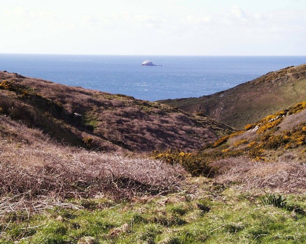 the north running boundary drawn for this region, (see map on page 3), is occasioned by the head of Baxter's Valley, one of the three arms of Les Trois Vaux starting a few dozen metres from the top of the Telegraph steps. Here the metalled track from the old Military Road turns into a grassy track leading straight on to the headland Tête de Judemarre and at the same point a, now barely discernible, track through the first 50m or so of bracken and bramble at about 45º to the right, leads down at slightly wider path to the main valley below. The offshore stack Ortac, with its large Gannet colony from January to about October can be seen, about 1 mile offshore, directly in line with the end of this valley (Figure 102 on right).
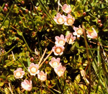 The valley narrows and the sides become steeper as you descend. Within about 150m a spring makes this path very damp and gradually the flow increases with running water in a narrow groove which moves from one side of the track to the other as the underlying rock strata dictate. Here you will find what is probably the only colony of Bog Pimpernel (Anagallis tenella), in the island, (Figure 103 on left).
A number of sedges and rushes and large colonies of Water Mint (Mentha aquatica) and Common Fleabane (Pulicaria dysenterica), will be noted along the course of this tiny stream. Close by the Pimpernel and a little downhill, look for Marsh Pennywort (Hydrocotyle vulgaris) either side in the wet ground. This is also rare i
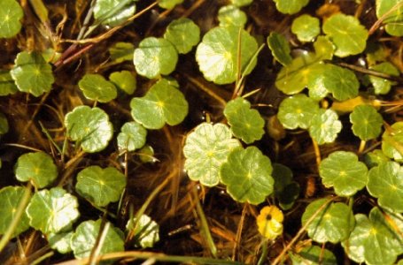 n Alderney, but I found it in great quantity in the almost dried up bed of Longis pond in 1992 (Figure 104 on right, taken in Baxter's Valley).
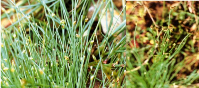
The valley widens out as it approaches the main arm of Les Trois Vaux and, at the junction, a small scrape of barish rock partly filled with water from the junction of the streams holds colonies of Common Spike-rush (Eleocharis palustris), Bristle Club-rush (Isolepis setacea) (See Figs. 105/6 below on left) and Slender Club-rush (I. cernua). the former with (as the photo on the left shows) a very much longer bristle, overtopping the inflorescence, is much rarer than its fellow (on the right). .
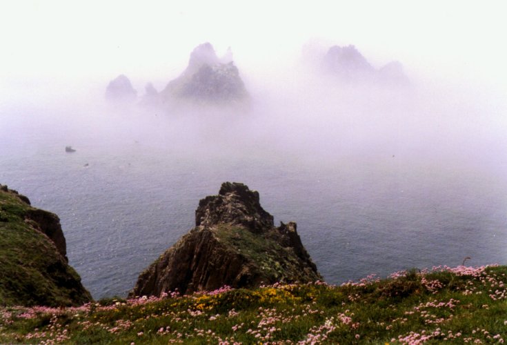
 The main valley runs roughly NE-SW with Les Etacs, otherwise known as the 'Garden Rocks', the main gannet colony, now occupying even the lower stacks in this small group, about 600m offshore, exactly opposite the bottom of the valley, (Fig. 107 on right in mist). At the appropriate season, the SE facing slope of the v
 alley is, in some years an almost solid mass of white flowered Ox-eye Daisies. The stream discharges onto the beach over a low cliff at the bottom of the valley. In the 17-18th centuries this was a prime smuggler's cove, formerly with a set of wooden steps called Les Dègrées giving access to the beach. The stream runs just in front of the dark green vegetation on the right (Fig 108 on left below), and, as is apparent in the photo, the 'head' of the crumbly cliffs on this part of the island is frequently eroded by storms, with landslides to the beaches below and resulting loss of vegetation. The third arm is much less steep sided and runs down above Baxter's Valley, from the north side of La Houguette de la Taillie, originally a Neolithic burial site and later, from the 11th Century, the site of Alderney's first windmill.
 Returning, (at least in thought), for a moment to the top of Baxter's Valley, the track going straight on from the junction also has a rich flora. Foxgloves (Digitalis purpurea) abound amongst the Gorse and Heathers. The short turf of the track holds several more scattered patches of Lousewort, frequent plants of tall Heath Groundsel (Senecio sylvaticus), a number of other small, yellow, Daisy family species, including the Smooth Cat's-ear, Trailing St. John's-wort and also the two Bird's-foots mentioned in the previous chapter. These two and the Cat's-ear are all three present in considerable quantity in the short turf area at the top of the slope of Tête de Judemarre, at the end of this track, looking down into Trois Vaux.
Large areas of Gorse clothe the top of the cliffs here, either side of the track and down the adjacent southern slope of Baxter's Valley, although a large part of the cliffs between Telegraph Bay and here has been almost bare of vegetation since hurricane force gales in January 1990. From 50 or 60m inland the land is covered with a peaty soil, much undermined with Rabbit burrows and several German bunkers and clothed with large areas of Bell Heather (Erica cinerea) and Heather (Calluna vulgaris) as well as the Gorse. Autumn Squills and Autumn Lady's-tresses orchids are also found here in season.
From the grassy slope just mentioned a very steep path, almost like a set of earth steps l
 eads down to the bottom of Trois Vaux, just above the cliff edge. On the seaward side of the climb up to the Giffoine, Thrift, Prostrate Broom, Sea Beet, Ox-eye Daisies and many other maritime plants will be noted (Fig. 109 on right). The Prostrate Broom in particular extends round much of this part of the cliffs and round the first part of Hannaine Bay. Excellent views of the Garden rocks and the Gannet colony are obtained from this section. Amongst the thick gorse on the flat part at the top of the Giffoine, very small numbers of Dartford Warblers have been nesting in the last few years.
Turning north, in the first small bay on the north-western side of the headland, look for the nesting sites of a colony of 40+ pairs of Fulmars, usually present from late January to early September and frequently seen gliding stiff-winged in the cove below. In 1999-2000 at least one pair of the Ravens, displaced from the cliffs near Quatre Vents nested along this stretch of the cliffs. Further north again, several pairs of Puffins nest in the cliff face and on the vertical faces of a couple of small outlying rock stacks, just a few metres offshore. Just to the N of these rocks there is a clear sandy bottom to part of the bay and Puffins can sometimes be seen floating here, or swimming underwater when the sea is calm.
The Giffoine was one of the strongest defence positions erected by the Germans on the island, with a battery of 3 x 15cm captured Russian Naval guns installed in the three large circular gun pits. These had a range of about 20-25,000 metres and their field of fire overlapped that of other large batteries on Guernsey to cover the whole sea area between the two islands. A huge rangefinder, a searchlight position overl
 ooking the Swinge and many other bunkers and defence works are scattered across almost the whole of this section on our map. Today most of the formerly cultivated area is a dense tangle of Gorse, Bramble, Honeysuckle and Ivy with patches of Hawthorn, Blackthorn and Elder bushes. The path along the cliffs is not easy to follow, but was cleared to some extent in 1998/99.
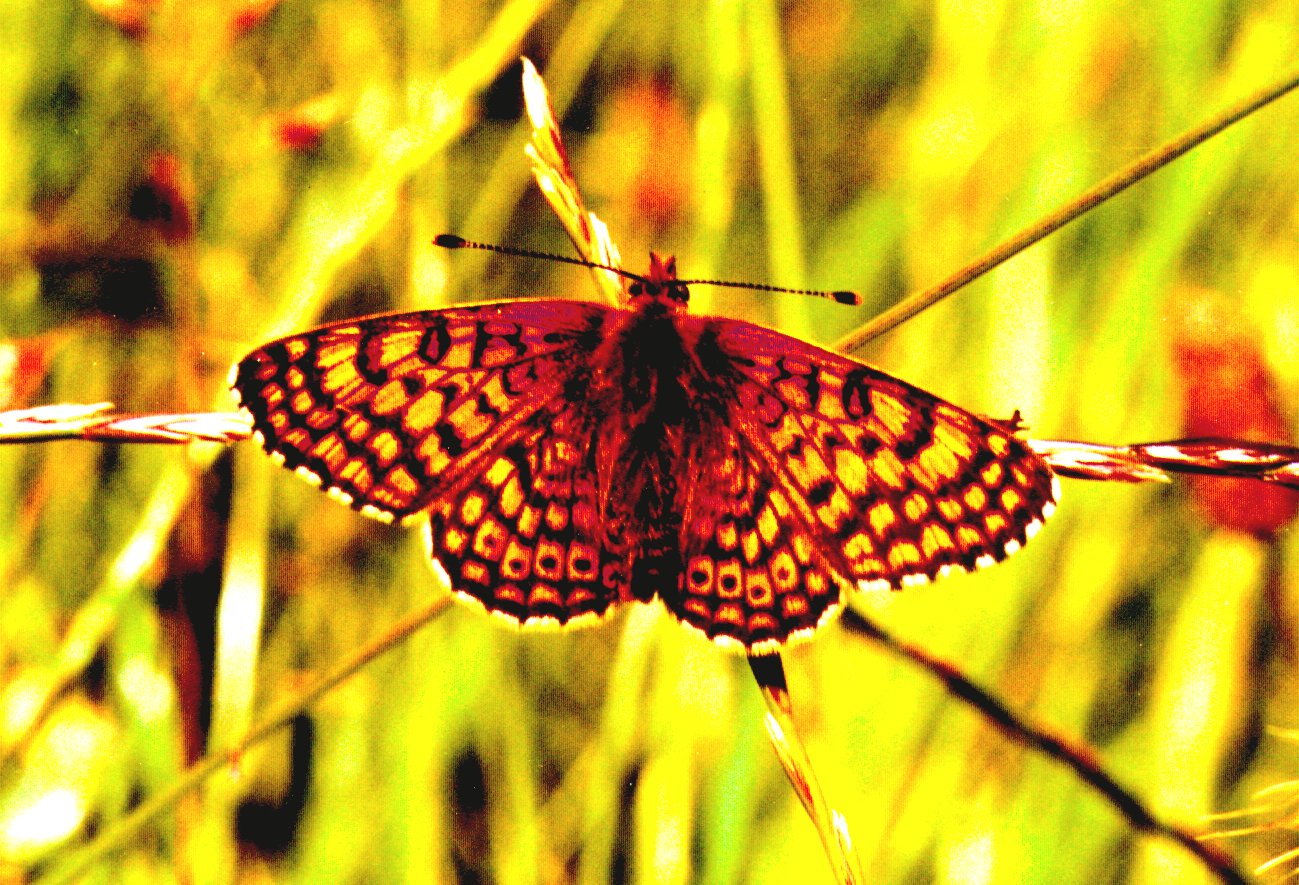
Following the coastal path northwards, a steep climb down to a broad shallow valley and a short upward climb along the path brings you back to one of the bends in the Zig-Zag at the start of our first Section of this work. At the right time of year, June-August Glanville Fritillary (fig 110 on right), and many other butterflies are frequent along this stretch.
Hen and Marsh Harriers usually only in passage for a few hours, the occasional passing Buzzard and resident Sparrow Hawk add to the frequent resident Kestrels seen flying along here, to give an interesting raptor fauna. In the maze of narrow tracks left by walkers
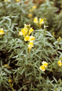 between the coast and the roadway, you may be lucky enough to see a Slowworm, apparently quite common along most of the S and SW cliff areas; these legless lizards, Alderney's only indigenous reptile, are rarely seen and, if disturbed, quickly vanishing amongst the grass roots. Amongst the dense vegetation, along the edge of one path a large colony of bright yellow Common Toadflax (Linaria vulgaris) may be found, (Fig. 111 on left). This is the only place I have ever found this plant in Alderney.
....
.
.
.
.
.
.
.
The last Section in Part 1 of this book follows and deals with the offshore islets of Burhou, Little Burhou and Les Casquets and the major offshore stacks.
.
