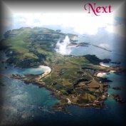
Alderney, the third largest Channel Island, has an area of just under 2,000 acres. It lies in the mouth of the English Channel, with its centre at about 2º11'45"W, 49º43'N and its main, 3½ mile, axis running NE-SW and is about 1½ miles across at its widest point. The southern and western sides form a plateau about 85m high, sloping steeply down towards the north and east to form a narrow coastal belt at about 3-10m above HWM.
Geologically the western half of the island has underlying greenish-grey granodiorite, covered for the most part by a gritty, sandy, head of decomposing rocks and wind-blown loess. A central triangular band of diorite stretches across the island from Cachalière to Braye Bay and Corblets Bay, whilst the south-eastern half of the cliffs and the low eastern end of the island is overlain with a thick layer of the hard Alderney sandstone, which also covers the extreme edge of much of the northern coastline and forms all of the offshore reefs, stacks, islets and islands, stretching some 25 miles due west, from Le Cap de la Hague, on the Normandy coast to the Casquets. A large area of the northern and eastern sides is covered with windblown sand forming a permanent dune system stretching across the top of the lower part of the island from Braye Bay to Longis Bay and along the northern coast from Corblets and Saye Bays in the east to Tourgis Point at the NW end. At the western end, Platte Saline and the area immediately behind it, up to about the 60m. contour line, forms another ancient, permanent dune system. There is evidence of former raised beaches at the 8 and 18m levels in a number of spots along the N and NW sides and on the offshore islands; remnants of the time when these areas were underwater during the various ice-ages.
A number of small, spring-fed streams run down the narrow valleys spaced along the S & W coasts and down the fewer but wider north facing valleys. The largest of these streams, in Bonne Terre, nowhere exceeds 1m. in width and about 20-30 cms. in depth.
The soil is generally neutral to slightly acid, except in many of the sandy parts, where crushed mollusc shells impart a degree of alkalinity and support calcicolous (lime-loving) species of plants and animals.
Please Note;
(a); An A4 map of the island, drawn by the author, showing the UTM grid numbers and names of most of the features, appears as the frontispiece of the printed version, or, as a full A4 size file in the CD version (File Alderne.jpg), which the user can print if required.
(b); A geological sketch map, also drawn by the author, is also included immediately below.
(c); 1. Throughout this part of the work the scientific names of plant and animal species will be given, in italics, following their common names, (where they have one), on the first occasion of their use. Thereafter only the common names will be used. Thus, in general, scientific names will only occur once in the index.
2. In general, only common names will be used in the Diary section.
3. A note on Protective Legislation for the Alderney flora, fauna and environment will be found in Appendix 1, at the end of the work.
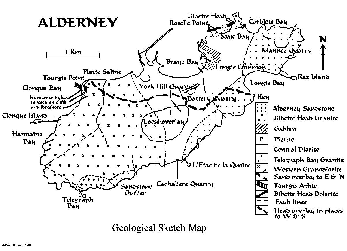
Figure 1.
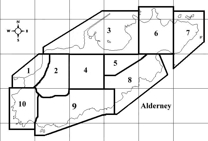
For the purposes of describing the ecology of Alderney, a division into ten more or less coherent "regions", shown on the accompanying map (Fig. 2) will be made.
Figure 2. Map of Alderney showing 1Km grid and regions referred to above
Each of these ten regions will be dealt with in a separate chapter, linked to the previous one by the "Next" button.
Please note; A few of the picture links in the next chapters may need to be clicked twice depending on the browser you use.
The islands of Burhou, Little Burhou, Les Casquets and the offshore stacks will be treated as a separate unit.
A separate chapter will be devoted in due course to various fauna distributed across the island, with no specific habitats.
Click the Eco03 link to go to the next page,
.
Remainder of Part 1.
.
Region 1. NW. coast. Eco03.htm
Should you prefer to go directly to any of the other Regions shown on the map above, please click on the appropriate link below;
Region 2. La Petite Blaye Eco04.htm
Region 3. The North Coastal strip Eco05.htm
Region 4. The Town of St. Anne Eco-06.htm
Region 5. Les Rochers Eco07.htm
Region 6. Mannez & Longis Eco08.htm
Region 7. The East Coast, to Longis Bay Eco09.htm
Region 8. S.E. Coast, Longis Nunnery-Bluestone Bay Eco10.htm
Region 9. South Cliffs to Telegraph Bay Eco11.htm
Region 10. SW. & West Coasts. Telegraph Bay and the Giffoine to Trois Vaux Eco12.htm
Region 11. Burhou, Little Burhou & the offshore islets and stacks Eco13.htm
Alderney's Ramsar Site. Map and reports, including lists os Marine Algae and Invertebrates Eco14.htm
An Index to the places in Part 1. with links to each file Ecoind.htm
List of Illustrations to Part 1.
.
Part 2.
A Monthly Nature Diary of the Island throughout a year aldnatdi.htm with links to each month
.
Part 3.
Various species records
Alderney Bird List Pages 197-202
Alderney Dragonfly List Page 203
Alderney Butterfly List Pages 204-206
Alderney Macro-moths List Pages 207-214
Alderney Plant List Pages 215-228
Alderney Fish List Pages 229-234
.
Appendices.
1. Protective Legislation Pages 235-240
2. Climate tables Pages 241-244
.
Annual updates. File AVWUpdate.htm
Numbers 1-3; 2005-2007 Weather, Botanical and Alderney Wildlife Trust Reports Pages 1-21
This file will be added to each year to keep the records up-to-date. The file name will remain the same.
.
.
.Click the icon above to return to the home page and an opportunity to view the other books on this disc, or click the "Next" link below to go straight to the first file of the ecological survey, Section 1 N-W Coast